|
Like all cultural landscapes, Fort Slocum was comprised of many elements. Buildings, open spaces and vegetation all contributed to the postŌĆÖs appearance and accommodated its mission. Other less noticeable elements also helped create a habitable and functioning landscape. Its seawall girded the shoreline of Davids Island and protected it from flooding during high tides and storms. Roads and walkways crisscrossed the post to knit it together, enabling people and vehicles to circulate easily around the island.
The Army built the seawall at Davids Island out of stone and concrete. Construction spanned several stages between 1889 and about 1942. When it reached its final form, the seawall protected about 81 percent of the islandŌĆÖs 8,700-foot-long shoreline, with gaps only where the shore was naturally high and rocky. The seawall stood 5 to 7 feet high and was 4 to 6 feet wide. In most places, the seawall stood in the intertidal zone and earth fill on the shore slightly expanded the dry ground of Davids Island.
Roads and Walls
01-Seawall Loc MapLocation of Fort Slocum's seawall. 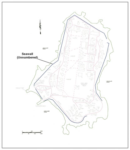  02-DI06k-10037The earliest section of seawall at Fort Slocum, completed in 1890, eastern shore of Davids Island, looking south, April 2006. 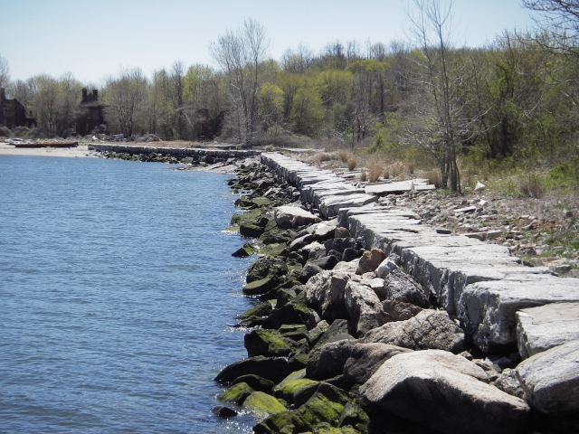  03-DI06k-11129Section of seawall completed about 1905, now in deteriorated to ruinous condition, western shore of Davids Island, looking south, April 2006. 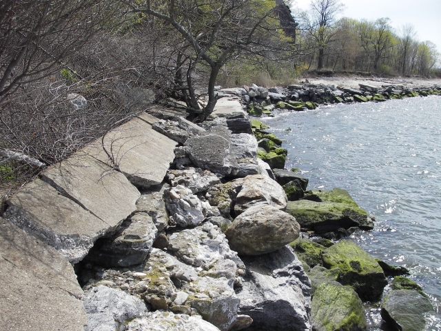 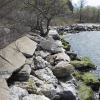 04-DI06k-12115Section of seawall (left) completed about 1908 between Freight Dock (pilings in foreground) and Passenger Pier (at right in water), southwestern shore of Davids Island, looking southeast, April 2006.  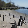 05-RoadsPaths Loc MapMap of Fort Slocum's roads and walkways, 1940s-2000s. 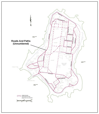 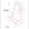 06-Hoyle Road w 163Hoyle Road along southern edge of Parade Ground, looking west, November 2005. 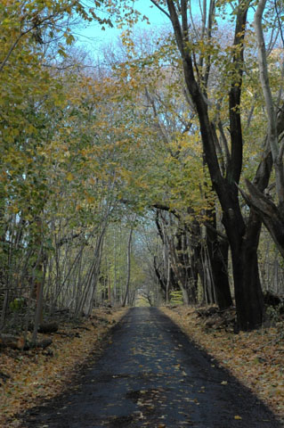  07-road on S side bldg 106 107 mHartshorn Road between the Non-Commissioned Officers Quarters (Buildings 106 and 107), at right, and a retaining wall for the Mortar Battery, at left, looking west, November 2006. 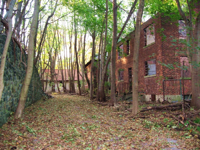 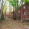 08-DI06k-10050Parker Road adjacent to the 1930s-era Barracks (Buildings 58 and 59), looking north, April 2006. 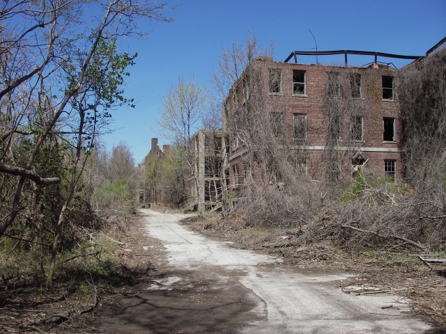  09-DI08k-45019Concrete-paved walkway on western side of Parade Ground, looking north along Officers' Row to one of the quarters (Building 9), April 2006. 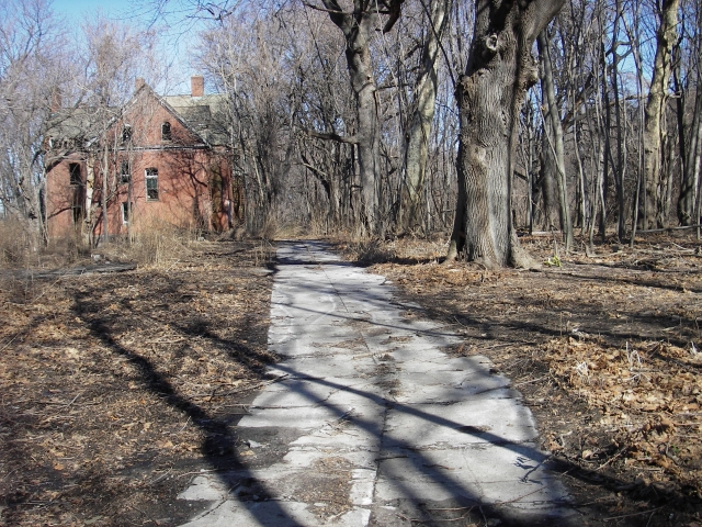  10-IMG_2331Brick-paved walkway revealed during demolition of Building 62, looking south-southwest, June 2007.  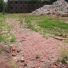
Inside the belt of the seawall, Fort Slocum had an extensive network of roads and walkways, which reached all parts of Davids Island. The roads were narrow, for there was relatively little vehicular traffic, but many of the walkways were wide, since personnel often traveled from place to place around the post on foot. (No two places on the island were more than a 15- or 20-minute walk apart).
Fort SlocumŌĆÖs system of roads and walkways grew as the post did. It originated with the postŌĆÖs Civil War predecessor, De Camp General Hospital, and expanded across Davids Island to the east and north from the main dock area (the Quartermaster Area) on the southwestern shoreline. The roads were originally graded earth, which was later covered with cinders or paved with macadam or concrete. Formal walkways at the post were originally built of wood boards, while informal paths were unimproved earth. In the late 1800s, brick walkways were installed, and these were later replaced with concrete.
The demolition of the ruins of Fort Slocum in 2005-2009 left the seawall and the roads and paths behind. Today, these features that encircle and cross the empty, wooded landscape are among the few reminders that the once-proud post occupied Davids Island.
|


