|
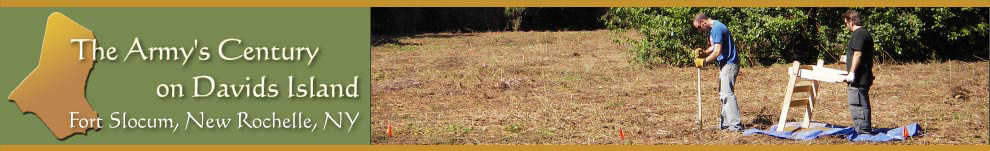
The archeological work sponsored by the U.S. Army Corps of Engineers sought to survey the sections of Davids Island where demolition activities were scheduled. Archeological surveys are quick and efficient overviews of the sites, ruins, deposits and other antiquities of a locality or region. They provide an initial but systematic overview of the ages, types, locations, patterning, integrity and other characteristics of the archeological resources of an area.
Survey Goals
For this project, an archeological survey was sufficient to allow the Corps of Engineers to plan the demolition work and minimize its effects on the archeological record. The information from the archeological survey of Davids Island was designed to reveal:
- The range of artifact types present;
- The distribution of artifacts across areas of the island affected by the project and within different soil layers (i.e., horizontally and vertically);
- How soils and the landscape of the island had been modified by past human activities; and
- The historical integrity of the archeological deposits.
How To
Archeo Survey Areas 2005-06Map of areas investigated during the 2005-2006 archeological survey of Davids Island conducted in preparation for the demolition of Fort Slocum's ruins. 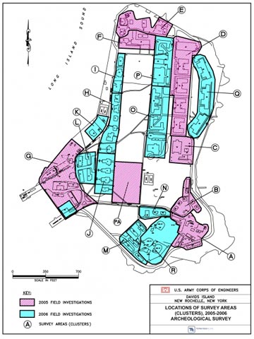  Arch_Testing_Officer_RowMap of the central portion of Officers Row, showing locations of different types of tests completed during the 2005-2006 archeological survey, including shovel tests, trenches, and test units. 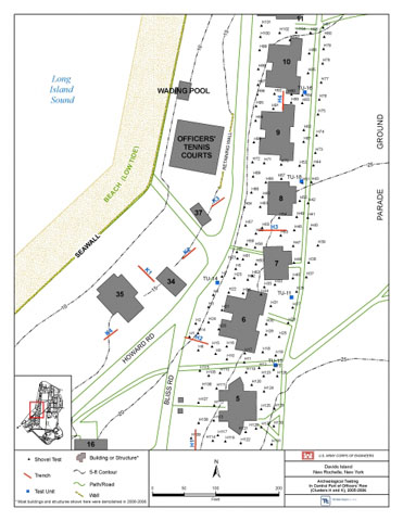  IMGP0105-adjArcheologists excavating a shovel test near the remnants of Building 120 in the Defense and Support Area, September 2005. 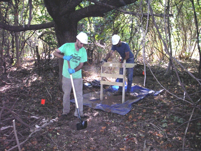  IMGP1933A mini hydraulic excavator digging an archeological test trench adjacent to Building 55 in the Barracks Area, September 2006. 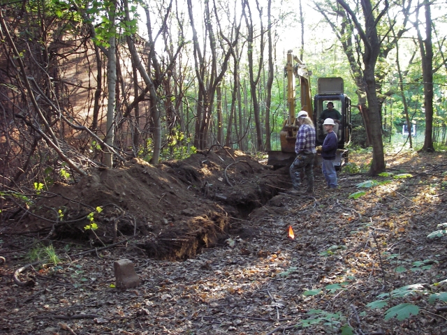  IMGP2171mTo record information revealed during archeological testing, two members of the field team prepare a measured drawing of soil layers in a trench near the foundation of Building 131 in the Defense and Support Area, October 2006. 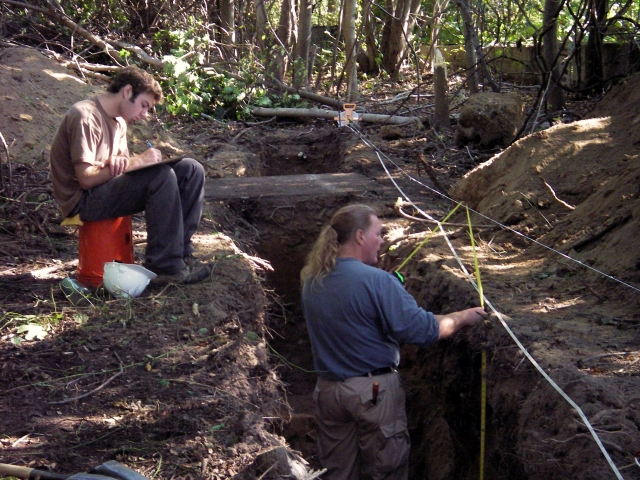  IMGP2338rmExcavation of a 1-meter (3.3-foot) square test unit, which provides detailed information about artifacts at different depths in the soil, near Building 3, October 2006. 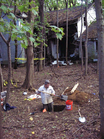 
Methods and Techniques
The archeological team on Davids Island used several different techniques to complete the survey in 2005 and 2006. These included surface reconnaissance, shovel testing, machine trenching and unit excavation. These methods allowed the team to cover a great deal of territory quickly.
Recordkeeping was a vital part of the survey. The team recorded the locations of each shovel test, trench and test unit on with a global positioning satellite system (GPS) receiver, supplemented by sketch maps in field notebooks. The archeologists kept notes on the results of the individual excavations through drawings and records on printed forms, and they also used still photography.
After fieldwork, the team processed the artifacts they had recovered. They cleaned the objects, identified and classified them, and created a computerized database of information about the objects, which was organized according to the excavation and layer from which objects came.
The last step of the survey was to synthesize the results, combining field observations, artifact analyses and data from historical documents to develop a richer understanding of prehistory and history on Davids Island. Through this synthesis, archeology provided an important complement to historical knowledge obtained through the study of documents like period maps and government records.
|


