


Archive  Photo Gallery History Recruits, Artillerists and Doughboys (1878 - 1922) 19-1894-Oct-Military Reservation
19-1894-Oct-Military Reservation |
|
- Description
-
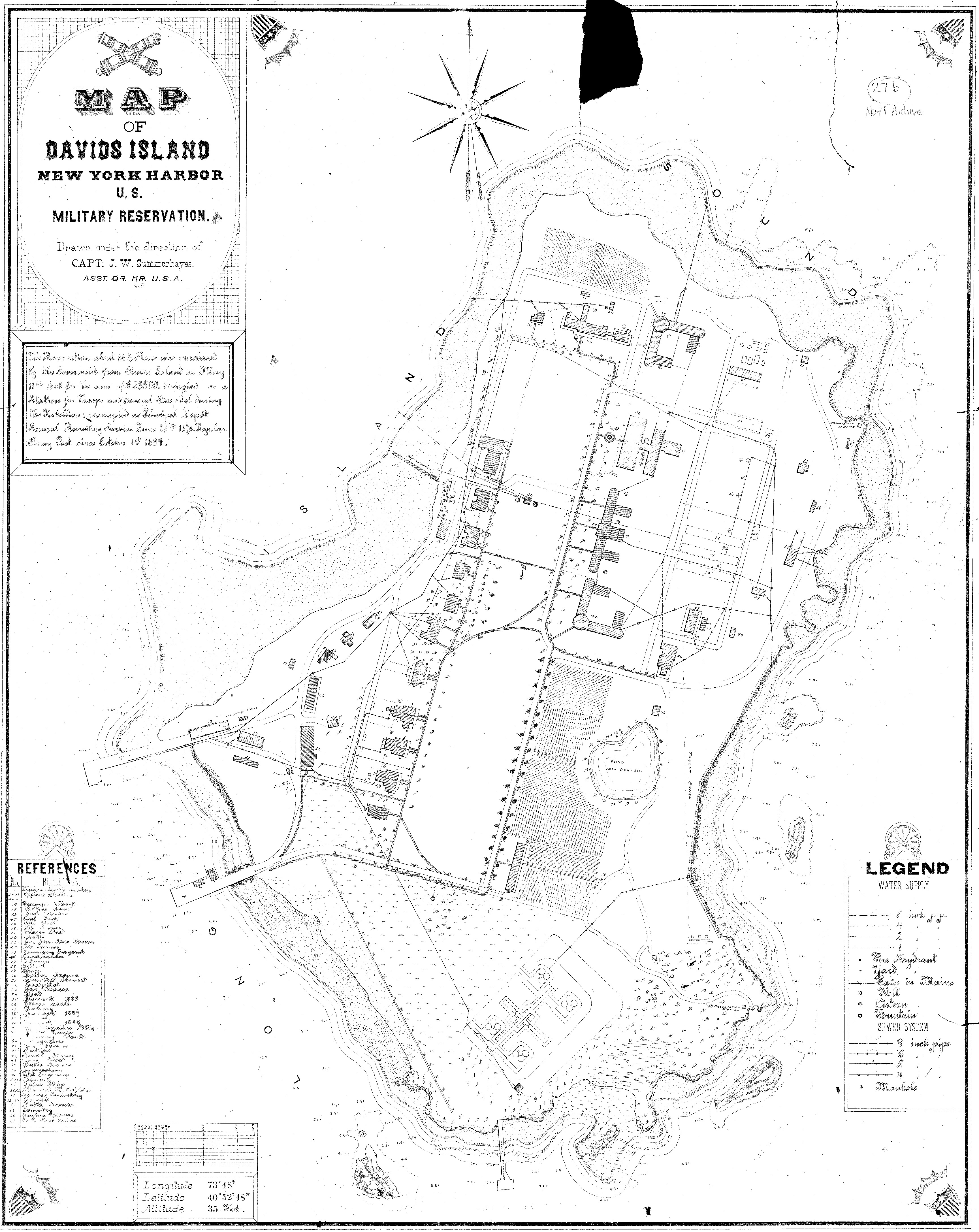
Map of Davids Island in 1894, shortly before the post was named Fort Slocum, prepared under the direction of the post's quartermaster, Capt. John W. Summerhayes.
- EXIF
-
Setting Value FileSize 3562083 bytes make ** No value available ** model ** No value available ** exposureTime ** No value available ** fnumber ** No value available ** DateTime ** No value available ** jpegQuality ** No value available ** aperture ** No value available ** meteringMode ** No value available ** flashUsed ** No value available ** focalLength ** No value available ** resolution 3457x4350